The University of Cape Town (UCT) is investigating a way to use a type of continuous wave (CW) radar to measure Antarctica’s sea ice levels.
UCT Masters student Dylan White told the recent South African Radar Interest Group (SARIG) conference at the CSIR in Pretoria that the two main types of radar are pulse radar and CW radar. Some uses of pulse radars, where a powerful pulse is emitted and then the return measured, include air traffic control, radar astronomy and mapping.
Some continuous wave radars are used in detecting improvised explosive devices (IEDs) in buildings, and landmines, as well as in areas that have been heavily bombed. Also, certain Ground Penetrating Radars (GPR) use CW radar. GPR is not only used for detecting dangerous objects, but also in archaeology, where it can save scientists time, letting them ‘look’ into the ground to see if there is an ancient wall or building, instead of digging test trenches.
Stepped Frequency Continuous Wave (SFCW) radar is a form of CW radar where even though the radar signal is continuous, the frequency is varied in discrete steps, allowing the radar to be more effective.
The UCT’s Marine and Antarctic Research Centre for Innovation and Sustainability (MARiS) amongst others studies the atmosphere-ice-ocean relationship and fosters research in remote sensing technology, low-cost instrumentation for sea ice imaging, and buoy observations. It aims to understand sea ice physical and mechanical properties, ocean hydrodynamics and more. White explained that CW radar techniques could be better used to measure sea ice, as existing models for sea ice were developed for the Arctic and cannot simply be projected onto the Antarctic.
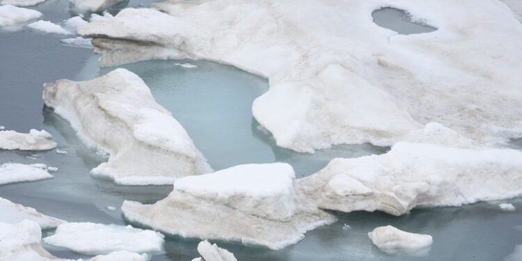
White pointed out that sea-ice is not what people usually think about when they think of polar ice, most of which is ‘calved off’ glaciers or shelf ice and is freshwater ice. Freshwater ice tends to float in large chunks, he said, whereas sea-ice is formed from sea water freezing. Sea-ice tends to form a layer of slush on the surface and later forms into ice fields.
Sea-ice is measured by its age and the least stable is younger than a year old. Standard maritime terms are used, the ‘freeboard’ of the ice is the part above water, while the ‘draft’ is the term used for what is below the water. White explained that sea ice was very porous, with ice channels where saline water runs off and ice bubbles form.
The primary method to be used for determining thickness is reflection. Radar reflections occur when there is a change in certain electromagnetic qualities of the material. Other methods include data captured by measuring the actual ice freeboard and calculating the area below the water, but this is not reliable as ice density varies. Another method involves measuring the surface temperature of the ice using satellite data, but this is only reliable for very thin ice.
Other methods include mathematical modelling of waveforms, which has its own troubles. Similar measurement campaigns include NASA’s ICEsat (Ice, Cloud and land Elevation) satellite, which operated from 2003 to 2010, and while its successor was being set up, Operation IceBridge was launched by NASA. The operation used a suite of aircraft-mounted sensors which included pulse radars which were primarily aimed at freshwater and shelf ice and ran until 2020, and was eventually replaced by ICEsat-2, launched in 2018 and currently operational.
Measurements produced by IceBridge, using Lockheed P-3 Orion, Douglas DC-8 and other aircraft, working with the Center for the Remote Sensing of Ice Sheets (CReSIS) at the University of Kansas continued the work of ICEsat. Unfortunately, these measurements were not ideal for sea ice, concentrating as they did on shelf ice.
This means that no operation has yet successfully been launched to specifically study Antarctic sea ice.
White said: “If we’re actually successful at this, we would be one of the first groups to do it.” He hopes to get similar data to IceBridge, but rather than mounting the radar on an aircraft, it would be fitted to the SAS Agulhas II, South Africa’s icebreaker and research ship, which is where the Stepped Frequency CW radar would come in.
By using Stepped Frequency CW radar, the MARiS team hope to get broader bandwidth and measure between layers of sea ice. The MARiS system has not yet been tested under static conditions, but it is hoped to do testing on ice ‘grown’ under static conditions.


