

A tool developed at Texas A&M University is set to transform how emergency responders assess damage after disasters. The technology, known as CLARKE (Computer vision and Learning for Analysis of Roads and Key Edifices), uses artificial intelligence and drone imagery to evaluate damage to buildings, roads and other infrastructure in a matter of minutes.


CLARKE was created by a team of researchers led by Tom Manzini, a Ph.D. candidate in computer science and engineering, and Dr. Robin Murphy, a pioneer in the field of rescue robotics.
“This is the first AI system that can classify building and road damage from drone imagery at this scale and speed,” Murphy said. “We’re talking about assessing a neighborhood of 2,000 homes in just seven minutes. That kind of speed can save lives and resources.”
The system has already proven its value during the 2024 hurricane season, when it was deployed in Florida and Pennsylvania following Hurricanes Debby and Helene.
The magic of machine learning
The name CLARKE is a nod to science fiction writer Arthur C. Clarke’s quote: “Any sufficiently advanced technology is indistinguishable from magic.” According to Murphy, the name was inspired by drone pilots working with the system who began calling its machine-learning capabilities “magic.”
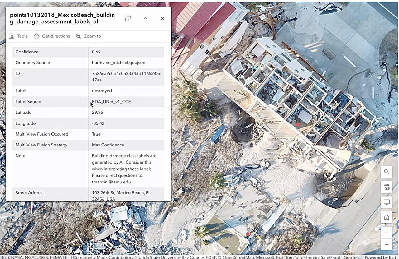
But there’s nothing mystical about the science behind it. CLARKE uses cutting-edge computer vision and machine-learning algorithms to analyze drone footage, overlay damage assessments on maps, and generate spreadsheets listing each structure’s address and damage level. For roadways, it even includes a Google Maps-style route planner that helps responders avoid impassable roads.

“CLARKE doesn’t just tell you what’s damaged, it tells you how to get around that damage,” Murphy said. “That’s critical when every second counts.”
In rural or hard-to-reach areas, traditional damage assessments can take days, delaying aid and complicating logistics. With CLARKE, officials could launch drones and receive a comprehensive damage report within minutes, dramatically accelerating response times.
“Rural counties often have lost wireless connectivity so they can’t send imagery to state and federal agencies for manual inspection,” Murphy said. “CLARKE empowers them to take immediate action.”
The system was trained on drone images from over 21,000 houses across 10 major disasters, including Hurricanes Harvey and Ian. This extensive dataset allows CLARKE to recognize a wide range of damage patterns, making it adaptable to different types of disasters, including hurricanes, floods and wildfires.
Training the front lines
While the technology itself is groundbreaking, its success depends on the people using it. Last month, more than 60 emergency responders from 38 agencies and eight private companies gathered in Tallahassee, Florida, for a two-hour awareness training session on CLARKE.
The event, hosted by Florida State University, was expected to draw 15 to 20 participants but ended up with nearly 100 registrations, highlighting the growing interest in AI-driven disaster tools.
David Merrick, program director of the Emergency Management and Homeland Security Program at Florida State University and task force lead for unmanned aerial systems for the state of Florida, praised the system’s capabilities.
“This is a game changer for rural counties—they can fly drones and then immediately understand the extent of damage in their area rather than wait days for the information from other sources,” Merrick said. “It will help make damage assessment more efficient and effective.”
CLARKE’s development began in 2022, and its creators continue to refine the system based on real-world feedback. After its deployment in 2024, the Texas A&M team participated in a tabletop exercise hosted by the AI Institute for Societal Decision-Making at the Florida Office of Emergency Management in April 2025 to gather input from responders. That session not only generated valuable suggestions but also sparked demand for formal training, leading to the June event in Florida.
Murphy sees a bright future for CLARKE, both as a practical tool and as a platform for further research.
“We’re not done,” she said. “We have already uncovered major fundamental gaps in machine learning for these types of imagery, which are similar to problems in medical imagery as well.”
Texas A&M University
Citation:
AI tool transforms drone images into instant disaster area maps for responders (2025, July 31)
retrieved 31 July 2025
from https://techxplore.com/news/2025-07-ai-tool-drone-images-instant.html
This document is subject to copyright. Apart from any fair dealing for the purpose of private study or research, no
part may be reproduced without the written permission. The content is provided for information purposes only.


