
One of the biggest obstacles to harnessing Earth observation (EO) data is the immense time, cost, and expertise required to transform raw satellite imagery into actionable information. Digital Earth Africa (DE Africa) has set out to eliminate this hurdle by using Analysis-Ready Data (ARD) and the Open Data Cube (ODC) to make satellite imagery accessible, user-friendly, and impactful.
“Earth observation data is one of the most powerful tools we have for addressing critical challenges like climate change and resource management,” says Dr Lisa-Maria Rebelo, Acting Managing Director and Lead Scientist for DE Africa.
“However, the sheer volume of raw data can overwhelm many users, creating a major barrier to its use. By providing analysis ready data cubes, we are removing this obstacle for Africa’s stakeholders and ensuring that users across Africa have the tools they need to address the continent’s most pressing challenges.”
The Open Data Cube advantage
The system at the heart of DE Africa’s success is the Open Data Cube, an open-source software platform that simplifies the storage, processing, and analysis of EO data. Originally developed by Geoscience Australia, the African version of the ODC is hosted at Amazon Web Services in Cape Town, ensuring data remains accessible across the continent.
The ODC stores processed EO datasets as cubes, allowing users to quickly retrieve and analyse data without starting from scratch. This eliminates the need for expensive computational infrastructure and complex software, enabling organisations with limited resources to access high-quality Earth observation data.
“This technology is leveling the playing field,” says Dr Rebelo. “Researchers, policymakers, and grassroots organisations now have access to the same datasets as global institutions, but without the steep learning curve and resource demands of traditional EO platforms.”
The open-source design of the ODC also promotes transparency and collaboration. Users can develop custom algorithms in Python or leverage existing Python notebooks provided by DE Africa to conduct sophisticated analyses tailored to their needs.
Breaking barriers with analysis-ready data
EO data requires extensive preprocessing to correct for atmospheric conditions, align sensors, and standardise outputs before it can be analysed. This preprocessing stage is time-consuming and often needs to be repeated by each user of the dataset, consuming weeks or months of resources.
For instance, a single set of satellite images might need to be processed over 40 times. DE Africa and the ODC eliminate such redundancies by providing ARD, which is preprocessed and ready for immediate analysis.
“By reducing the complexity of dealing with raw satellite data; we ensure that users can focus on actionable insights without being held back by time-consuming preprocessing stages,” says Dr Rebelo.
The ARD provided by DE Africa is particularly important for applications that require time-series data, Rebelo adds. “Analysts can now easily track trends over months or decades to understand phenomena like changing water levels, deforestation patterns, or urban growth.”
Tracking trends over 40 years
DE Africa’s ARD is built on an impressive archive of over 40 years’ worth of satellite data, offering unparalleled insights into Africa’s landscapes and resources. Through the Open Data Cube, this historical data is made accessible in a structured and efficient way, reducing the time needed to preprocess raw data and increasing its practical value.

This foundational capability underpins services like DE Africa’s Waterbodies Monitoring Service, which provides critical data on over 700,000 unique waterbodies across the continent. Using decades of satellite observations, the service tracks lakes, rivers, ponds, reservoirs, and wetlands, and it updates information on their surface areas on a weekly basis.
“The Waterbodies Monitoring Service offers unprecedented insights into Africa’s freshwater resources,” explains Dr Rebelo. “For example, the ability to track changes in waterbodies over the past 40 years provides governments and researchers with the long-term data they need to make better plans, prepare for climate-related risks, and manage resources more sustainably.”
These services are not only comprehensive but also practical. Users can query data via an API, integrating it directly into applications and creating customised analyses tailored to specific needs, such as monitoring seasonal water availability or identifying flood-prone areas.
DE Africa’s thematic applications
DE Africa’s ARD and the ODC power a diverse set of thematic services tailored for African challenges, including:
- Water monitoring: Prepackaged services track water bodies and detect changes in water quality over time. For example, Digital Earth Africa data can be used to inform disaster response and resilience strategies amidst fluctuating climate patterns, from severe droughts to flooding, such as in Garissa, Kenya.
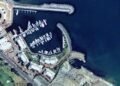
- Coastline monitoring: Tools help policymakers understand and respond to erosion or shifts in shorelines. For example, a project led by Dr Pamela Ochango aims to preserve African heritage sites by integrating archaeology with satellite science to map coastlines in Kenya, Tanzania, and Senegal, revealing the risks faced by these culturally rich areas to inform conservation efforts.
- Agriculture and vegetation analysis: Data supports better agricultural planning and detects stress in vegetation due to droughts or pests. A project led by AGRHYMET, in collaboration with Digital Earth Africa, focuses on improving agricultural monitoring in Niger and Burkina Faso. By integrating high-resolution satellite analysis with field verification, the initiative aims to enhance crop mapping accuracy, supporting sustainable farming practices.
- Africapolis notebook was developed using DE Africa data, enabling users to analyse green spaces in urban areas.
The impact of these services is amplified by DE Africa’s continuous expansion of its dataset catalogue. Recent efforts include the integration of higher-resolution imagery and datasets optimised for critical applications like water quality monitoring.
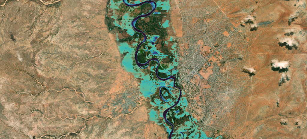
Floodplain monitoring in Garissa, Kenya
Empowering Africa’s stakeholders
By addressing the barrier of raw data complexity, DE Africa is enabling stakeholders across the continent to unlock the full potential of Earth observation data. Researchers have unprecedented access to decades of historical EO datasets, enabling long-term studies on environmental trends.
Local governments and policymakers are using these tools to develop climate-resilient strategies and improve disaster management. NGOs can now rely on data-driven insights for conservation and humanitarian projects. For example, M.A.P. Scientific Services (MAPSS) leverages the power of Digital Earth Africa and ESRI to provide geospatial solutions for wildlife conservation across Africa.
Using satellite data, MAPPS can perform detailed land cover classifications, create predictive models for habitat suitability, and design wildlife corridors to minimise human-wildlife conflict. Their work supports large NGOs and government bodies, providing them with the spatial context needed for informed decision-making.

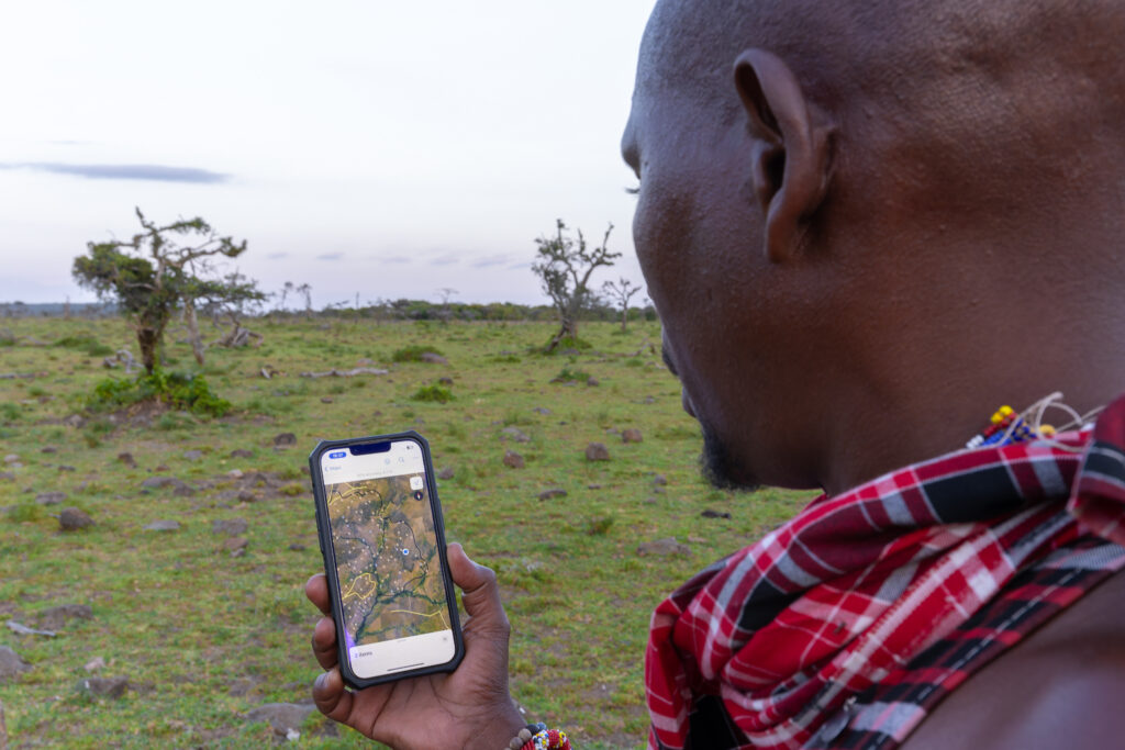
Field Validation in Kenya for MAPPS
“At DE Africa, our mission is to ensure that the decision-makers, scientists, and communities across the continent can fully use the power of Earth observation,” says Dr Rebelo. “The platform’s user-friendly approach ensures that even organisations with limited technical capacity can harness the power of EO data, improving equitable access to this vital resource.”
Shaping the future of innovation
Looking ahead, DE Africa continues to push the boundaries of what’s possible with EO data. The programme’s commitment to expanding datasets, improving user resources, and fostering pan-African collaboration will be key to tackling the continent’s future challenges. By addressing the barriers to data accessibility, they are transforming raw patterns in the Earth’s landscapes into actionable insights, helping Africa shape a brighter and more sustainable future.


